
|
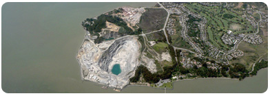 |
Point Pedro is a town, located in Jaffna District, Northern Province, Sri Lanka, governed by an Urban Council. The agriculturally active area around Point Pedro with fertile calcic red latosols is known for its cotton production |
|
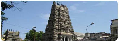 |
Jaffna is the capital city of the Northern Province of Sri Lanka. It is the administrative headquarters of the Jaffna district located on a peninsula of the same name. With a population of 88,138, Jaffna is Sri Lanka's 12th largest city. |
 |
one of the finest natural deep-water harbors in the world is located 257 km north-east of Colombo, capital city of Sri Lanka. Trincomalee has some of the most scenic, and un-spoilt beaches in the country. As the sea in and around the bay is relatively shallow, the area is famous for bathing and swimming. . Recently Trincomalee has become popular for a Whale Watching destination too. The best time for sighting these beautiful creatures is from June to September. |
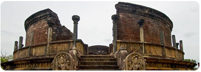 |
The first capital of Sri Lanka and remained so until 10th Century AD, its one the UNESCO World Heritage Site. Anuradhapura was first settled by Anuradha, a follower of Prince Vijaya the founder of the Sinhala race. Later, it was made the Capital by King Pandukabhaya. It is also one of the oldest inhabited city in the world. The city is considered very sacred by the Buddhist and is surrounded by the largest Dagobas. The city had some of the most complex irrigation systems of the ancient world, with many of the great reservoir tanks still surviving today |
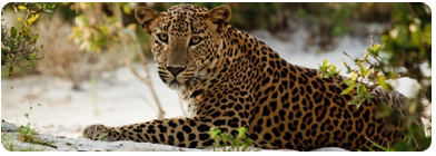 |
This is the largest National Parks in Sri Lanka covering 131,693 hectares and is situated in the northwest coast dry zone, located 30 km west Anuradhapura and 26 km north of Puttalam. Wilpattu National Park also known as “Land of Lakes” (Willu-pattu). It boasts impressive variety of flora and fauna. 31 species of mammals have being identified within the park, including Elephants, Leopards, Deer, Wild Boar and Sloth bears, Samba just few to name. What’s in Wilpattu is, it has a number of natural lakes. |
 |
Polonnaruwa, Sri Lanka's splendid medieval capital was established as the first city of the land in the 11th Century, A.D. It replaced Anuradhapura, plundered made desolate, and laid hopelessly bare to the invading armies from South India. Three Kings dominate the annals of the city and the period.
The city reached a dazzling but pitifully brief zenith in the 12th century and though ravaged by invasion in the centuries following, much evidence remains of the old grandeur and glory.
The ruins of the ancient city stand on the east shore of a large artificial lake, the Topa Wewa Lake, or Parakrama Samudra (the Sea of Parakrama), created by King Parakramabahu I (1153-86), whose reign was Polonnaruwa's golden age. Within a rectangle of city walls stand palace buildings and clusters of dozens of dagobas, temples and various other religious buildings. |
 |
Yapahuwa was one of the ephemeral capitals of medieval Sri Lanka. The citadel of Yapahuwa lying midway between Kurunagala and Anuradhapura was built around a huge granite rock rising abruptly almost a hundred meters above the surrounding lowlands. |
 |
Sri Lankan architectural tradition is well displayed at Sigiriya, the best preserved city centre in Asia from the first millennium, with its combination of buildings and gardens with their trees, pathways, water gardens, the fusion of symmetrical and asymmetrical elements, use of varying levels and of axial and radial planning.
The Complex consists of the central rock, rising 200 meters above the surrounding plain, and the two rectangular precincts on the east (90 hectares) and the west (40 hectares), surrounded by two moats and three ramparts.
The plan of the city is based on a precise square module. The layout extends outwards from co-ordinates at the centre of the palace complex at the summit, with the eastern and western axis directly aligned to it. The water garden, moats and ramparts are based on an 'echo plan' duplicating the layout and design on either side. This city still displays its skeletal layout and its significant features. 3 km from east to west and 1 km from north to south it displays the grandeur and complexity of urban-planning in 5th century Sri Lanka.
|
 |
Located in the districts of Matale and Polonnaruwa and bordered by the ‘Mahaweli' and ‘Amban' rivers, stretches an impressive 30,000 hectares. It was declared a National Park in 1984. The park is famous for the elephants, about 150 of them frequenting the Mahaweli River. These elephants are somewhat larger the ones in Uda Walawe or Yala, mainly due to the lush vegetation within the park that provides a more stable diet. It is also home to numerous other animals including Leopard, Sloth bear, Golden jackal, Wild boar, Wild buffalo, Sambar, Spotted and Barking deer, Fishing cat, Grey langer, the endemic Toque monkey and the Purple face leaf monkey. This park is truly a paradise for the nature lover. |
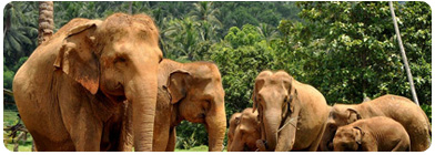 |
A breeding ground and a nursery for wild Asian Elephans in Sri Lanka. Located at Pinnawala Village in Sabaragamuwa Province,which is 13 km northwest of Kegalle. Elephant Orphanage was established in 1975 by the Department of Wildlife. The orphanage was primarily designed to afford care and protection to the many baby elephants found in the jungle without their mothers, most of these cases the mother had either died or been killed. Today Pinnawalla has the largest herd of captive elephants in the world and it is a famous tourist attraction. |
 |
Kandy is one of the most beautiful cities of Sri Lanka that is known for its scenic beauty and rich cultural value. Spread over an area of around 1940 square kilometers, it is counted amongst the world heritage sites of UNESCO. The city promises a number of tourist attractions that include the Old Royal Palace and the famous Temple of Tooth. The latter consists of the sacred relic of Buddha’s tooth because of which Kandy is regarded as one of the most sacred places by Buddhists. Other holy spots include the Gadaladeniya Temple and the Lankathilake Temple. The Old Royal Palace of Kandy is a treat for sore eyes and a treasure trove for history lovers. On one hand, you have the Queen’s chambers and quarters of the concubines and on the other, there are the armory and council chambers. |
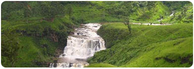 |
Nuwara Eliya is a mountain station at 1,868 m (6,128 ft) of altitude, in a splendid landscape. The city pretends to be particularly well-kept and neat, and the always green grass gives to the locality an aspect of “colonial British style".
Nuwara Eliya was built entirely during the 19th century and its architecture mimics that of an English country town, with red-brick walls, country house like hill club and mock-Tudor half-timbering.
Blessed with salubrious climate, breathtaking views of valleys, meadows, mountains and greenery; it's hard to imagine that Nuwara Eliya is only 180 Km from the hot and humid Colombo. Temperatures are 14C-21C (Jan- April) 16C-18C (May-Aug) 15C- 18C (Sept-Dec). |
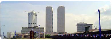 |
Colombo is the largest city and the commercial, industrial and cultural capital of Sri Lanka. It is located on the west coast of the island and adjacent to Sri Jayawardenapura Kotte suburb or the parliament capital of Sri Lanka. Colombo is also the administrative capital of Western Province, Sri Lanka and the district capital of Colombo District. Colombo is often referred to as the capital since Sri Jayawardenapura Kotte is a satellite city of Colombo. Colombo is a busy and vibrant place with a mixture of modern life and colonial buildings and ruins[2] with a population of about 752,993 in the city limits. It was the political capital of Sri Lanka, before Sri Jayawardenapura Kotte. |
 |
Know as Sri Pada in Sinhalese and Sivanolipatha Malai in Tamil, is a 2,243 metres (7,359 ft) tall mountain located in central Sri Lanka. Adam’s Peak is well known for the "sacred footprint", a 1.8 metres rock formation near the summit, in Buddhist tradition this is the footprint of the Buddha, in Hindu tradition that of Shiva and in Muslim and Christian tradition that of Adam, or that of St. Thomas. Access to the mountain is possible by 6 trails: Ratnapura-Palabaddala, Hatton-Nallathanni, Kuruwita-Erathna, Murraywatte, Mookuwatte & Malimboda. The Nallathanni & Palabaddala. However most common route taken by most pilgrims is ascent via Hatton and descent via Ratnapura; although the Hatton trail is the steepest, it is also shorter than any other trails by approximately five kilometers. The trails are illuminated with lights, making night-time ascent possible and safe for pilgrims. Rest stops and wayside shops along the trails serve refreshments to pilgrims. April is the peak pilgrimage season. Best is to do a night climb and to reach the top of the mountain at sunrise to witness the munificent view. |
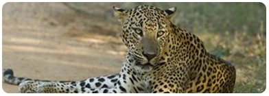 |
Yala National Park is the most visited and second largest national park in Sri Lanka. The park consists of five blocks, two of which are now open to the public, and also adjoining parks. The blocks have individual names such as, Ruhuna National Park (block 1) and Kumana National Park or 'Yala East' for the adjoining area. It is situated in the southeast region of the country, and lies in Southern Province and Uva Province. The park covers 979 square kilometres (378 sq mi) and is located about 300 kilometres (190 mi) from Colombo. Yala was designated as a wildlife sanctuary in 1900, and, along with Wilpattu was one of the first two national parks in Sri Lanka, having been designated in 1938. The park is best known for its variety of wild animals. It is important for the conservation of Sri Lankan Elephants and aquatic birds. |
 |
Lies on the boundary of Sabaragamuwa and Uva Provinces, in Sri Lanka. The national park was created to provide a sanctuary for wild animals displaced by the construction of the Udawalawe reservoir on the Walawe River, as well as to protect the catchment of the reservoir. The reserve covers 30,821 hectares (119.00 sq mi) of land area and was established as a National Park in June 1972. The area was used for shifting cultivation prior to the designation of the national park. The park is about 165 kilometers (103 mi) from Colombo City. Udawalawe is an important habitat for water birds and Sri Lankan Elephants. It is a popular tourist destination and the third most visited park in the country. |
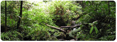 |
This is a biodiversity hotspot located near Ratnapura and is a nature lover’s delight. This hilly virgin forest was declared as a World Heritage site by UNESCO in 1989. This is the last remaining original lowland evergreen rainforest on the island and is home to a treasure-trove of endemic species including trees, insects, amphibians, birds and mammals.The forest covers an extent of about 11,000 hectares and has series of mountains and ridges rising abruptly from 90m to 1170m above sea level. Rainfall figures in the area show values ranging from 3,700 to 5,000mm. Average height of the trees varies between 35m – 40m with some even growing up to 50m. Out of the 211 woody trees identified within the reserve, 65% are endemic. Hence a higher degree of endemism has being observed amongst both fauna and flora in the forest. |
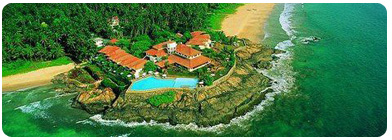 |
A famous tourist destination located on the southern tip of the Galle District of the Southern Province on the A2 highway. The name derived from a mythical story which dates back to kings time saying a demon called ‘Bem’ ruled this river. Bentota is a historical place and the Galapatha Viharaya is one of a cluster of five ancient temples in the region. Bentota is a famous destination for water sports. |
 |
This s a small town on the south coast of Sri Lanka. It is located in the Southern Province, about 17 km north-west of Galle. Hikkaduwa This is a popular tourist destination, renowned for its golden sandy beach and the beautiful coral reef. Most visitors to the city spend time either snorkeling or diving in the clear water and is probably the most environmentally friendly way to see the underwater world with many species of fish and crustacean. Glass bottom boats are also available for those who want to enjoy the wonders while keeping dry. For the diving enthusiast, there are more than 4 different shipwrecks to explore along with dive centers offering PADI courses and equipment. |
 |
| Udawalawe National Park lies on the boundary of Sabaragamuwa and Uva Provinces, in Sri Lanka. The national park was created to provide a sanctuary for wild animals displaced by the construction of the Udawalawe reservoir on the Walawe River, as well as to protect the catchment of the reservoir. The reserve covers 30,821 hectares (119.00 sq mi) of land area and was established on 30 June 1972.[1] Before the designation of the national park, the area was used for shifting cultivation (chena farming). The farmers were gradually removed once the national park was declared. The park is 165 kilometres (103 mi) from Colombo. Udawalawe is an important habitat for water birds and Sri Lankan Elephants. It is a popular tourist destination and the third most visited park in the country. |
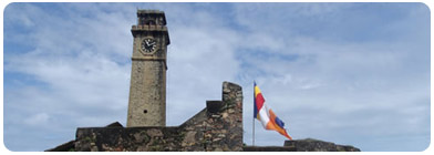 |
A major city in Sri Lanka situated on the southwestern tip of Sri Lanka, 119 km from Colombo. Galle is the administrative capital of Southern Province. Galle was known as ‘Gimhathiththa’, in the 14th century Ibn Batuta referred as ‘Qali’, before the arrival of the Portuguese in the 16th century. Galle’s geographical location on world sea routes made it an important port of call between the Middle East and the Orient. Its oldest landmark is the massive Portuguese and Dutch fort in which the central city is contained. The Galle Fort also known as the Dutch Fort or the “Ramparts of Galle” was built first by the Portuguese in 1588 and then, extensively fortified by the Dutch from 1694 onwards. This is the best example of a fortified city built by Europeans in South and Southeast Asia and is the largest remaining fortress in Asia built by the European occupiers. The Galle fort is a historical, archeological and architectural monument and has been inscribed as a cultural heritage site by UNESCO. Other prominent landmarks in Galle include the city's natural harbor, the National Maritime Museum, St. Mary's Cathedral, Shiva temples and Amangalla the historic luxury hotel. |
|


